
This climb links route 32 / 237 with route 496. Max Elevation 526 metres.
Strava Segments – Hokotate Pass, Route 237 / 32 to Tunnel, Route 32 Climb.
Much of the Keichiku area is a series of valleys radiating out from Mt Hiko. Route 237 follows one of these valleys, becoming route 32 on the way, and then winding over the Hokotate Pass to join up with Route 496 for the final climb up to Mt Hiko. The road follows the Kiigawa (River Kii) until the final 2.5 km or so (there’s a small forest road that carries on along the river) after which winds its way up to a tunnel at the Hokotate Pass.
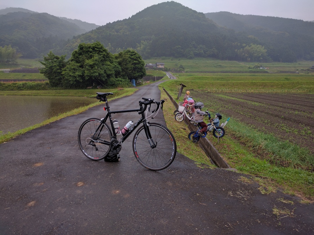
If you start the climb from the turn off from route 58, it’s 20.4 km. For the first kilometre the road runs almost flat through the rice fields on an alluvial plain, then after you pass under the Higashi Kyushu Express Way, you head into a gently narrowing valley. There’s a Daily Store on the right after about 1.7 kilometres, and that’s essentially the last shop for about 50 kilometres if you need to buy food.
For the next 10 or so kilometres the road is a gentle 2-3% through typical Kyushu countryside. About 11 kilometres in there’s a mildly creepy collection of scarecrow children to look out for.
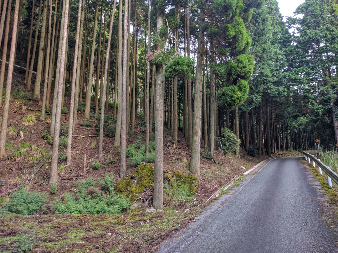
As the valley starts to narrow the gradient starts to increase a bit to about 5%, and the climb proper starts after Route 237 merges with Route 32. From here it’s an average of 7.3% for the final 4.2 kilometres. The road also narrows from here becoming single track, although the only traffic you’re likely to encounter is the occasional kei truck or more likely a few deer or wild boar. About half a kilometre after the route 32 junction, with the road hugging the left side of the valley, the rice fields give way to forest on both sides. If you’re in need of a drink, there’s a campsite and farmers’ market (I’ve never seen it open but there are vending machines for drinks) on the right.
After you pass the campsite there’s a hairpin over the river and on the left there’s a marker telling you you’re at bend number 1; the top of the pass is just after bend 25 (the last sign is bend 23). The rest of the climb is fairly typical for the area – twisty, mixed gradients, white guardrail on one side and rock face (mainly concrete) on the other. After heavy rain, there’s a good chance of chunks of rock up to about fist-size littering the road, and from November to April there’s a covering of leaves, pine needles and branches. The road can also be unpassable due to snow from December to the end of February, but it’s usually only for a few days at a time.
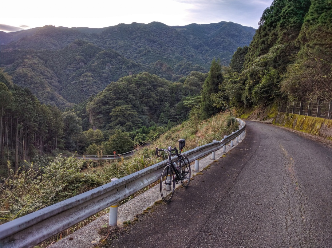
For the most part you are hemmed in by the trees on one side and the mountain on the other but there are a few places where the trees on the guardrail side have been felled and there’s some nice views of the surrounding peaks. With almost no traffic the only noise is the occasional bird or deer call and the sound of your own breathing / wheezing / heart exploding through your ears / badly set-up gears – delete as appropriate.
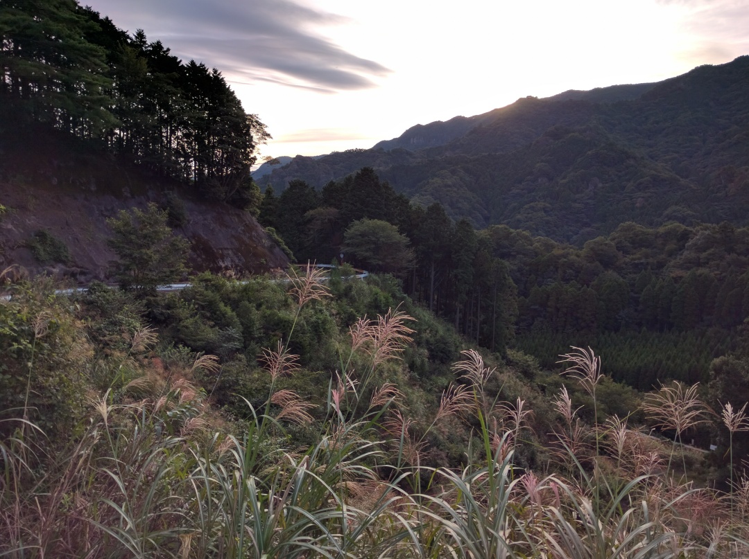
As you get to the pass there’s a set of three hairpins then the road flattens out to the (short) tunnel that takes you through from Chikujo machi into Miyako machi. Once through the tunnel it’s a similalry windy road down to Route 496, where you have the choice to climb up to Mt Hiko, hop across to the Saigawa Forest Road, or head back down to civilisation.

Great photos! Looks like a beautiful road
LikeLike
Thanks! It’s a great place to ride. I just need the weather to warm up a bit before I can head up there again.
LikeLiked by 1 person